The Science Behind Clouds: A Weather Station Perspective
Observing the sky is one of the most accessible and enjoyable aspects of running a DIY weather station. While sophisticated instruments measure temperature, pressure, and humidity, the simple act of looking up and identifying clouds can significantly improve your understanding of approaching weather patterns. This article explores the science behind different cloud types and how your weather station observations can benefit from cloud identification.
Why Clouds Matter for Weather Forecasting
Clouds are more than just fluffy formations in the sky. They are visible manifestations of atmospheric processes. Their type, altitude, and movement can indicate temperature changes, precipitation potential, and even the stability of the atmosphere. Recognizing cloud types is a crucial skill for anyone interested in DIY weather monitoring and amateur meteorology. For a successful DIY weather station, ensuring your equipment is accurately measuring these elements is paramount. Consider reading about thermometer calibration to ensure accuracy.
Basic Cloud Classification
Clouds are primarily classified by their altitude and appearance. Here's a simplified breakdown of common cloud types:
High-Level Clouds (Above 20,000 feet - typically composed of ice crystals)
- Cirrus (Ci): These are thin, wispy clouds often resembling delicate streaks. They generally indicate fair weather but can precede a warm front.
- Cirrocumulus (Cc): These appear as small, white patches arranged in a rippled pattern, sometimes called a "mackerel sky." They often precede a change in the weather.
- Cirrostratus (Cs): These are thin, sheet-like clouds that often cover the entire sky and can create a halo effect around the sun or moon. They frequently indicate an approaching warm front.

Mid-Level Clouds (6,500 to 20,000 feet)
- Altocumulus (Ac): These appear as patchy, sheet-like clouds often arranged in layers or rounded masses. They can indicate instability in the atmosphere.
- Altostratus (As): These are grayish or bluish-gray clouds that often cover the entire sky. The sun or moon may be visible as a dim disk through them. They often precede a larger storm system.
Low-Level Clouds (Below 6,500 feet)
- Stratus (St): These are gray, featureless clouds that often cover the entire sky, resembling fog that doesn’t reach the ground. They can produce drizzle or light snow.
- Stratocumulus (Sc): These are low, lumpy layers of clouds that often appear as rounded masses or rolls. They rarely produce significant precipitation.
Vertical Clouds (Bases typically low, but can extend through multiple levels)
Vertical clouds are often the most dramatic and potentially hazardous. Their unpredictable nature can be a sign of changing weather conditions, and it’s essential to have accurate wind measurements. Consider how your DIY wind vane is positioned and if it's providing reliable readings. You could find inspiration by reading our guide to building a DIY wind vane for more accurate data.
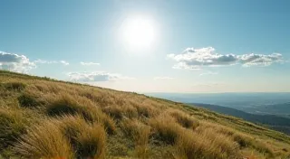
- Cumulus (Cu): These are puffy, cotton-like clouds with flat bases. Fair-weather cumulus clouds are a common sight on sunny days.
- Cumulonimbus (Cb): These are towering, thunderstorm clouds capable of producing heavy rain, hail, lightning, and even tornadoes. They are easily recognized by their dark, anvil-shaped tops.

Integrating Cloud Observations with Your Weather Station
Your DIY weather station can provide valuable context for your cloud observations. For example:
- Temperature & Cloud Type: Note the temperature as you observe cloud development. Rising temperatures can fuel cumulonimbus formation. Increased humidity often accompanies temperature rises, contributing to cloud growth.
- Humidity & Cloud Growth: High humidity often contributes to cloud formation and expansion. Measuring rainfall accurately complements humidity data, allowing you to understand precipitation potential. A properly calibrated simple rain gauge is an essential component for holistic weather station monitoring.
- Wind Direction & Cloud Movement: Observe how clouds move across the sky. This can indicate the direction of upper-level winds and the potential movement of weather systems. Changes in wind speed and direction can dramatically alter cloud behavior and precipitation patterns.
Simple Cloud Observation Tips
Beyond just identifying cloud types, consistent record-keeping is crucial. Imagine trying to track a seasonal rainfall pattern without a reliable means of measuring it! The same principle applies to cloud observations.
- Keep a Cloud Diary: Regularly record the cloud types you observe and the corresponding weather conditions. Include notes on wind speed, temperature, and any unusual occurrences.
- Use a Cloud Chart: A cloud chart can be a helpful reference guide for identification. Laminate your chart to protect it from the elements – just as you would protect your weather station equipment.
- Consider the Time of Day: Cloud formations often change throughout the day as atmospheric conditions evolve. Morning fog might clear to reveal a beautiful display of cumulus clouds by afternoon.
- Understand Atmospheric Stability: The stability of the atmosphere plays a significant role in cloud development. Stable air tends to suppress vertical cloud growth, while unstable air promotes it. Combine your cloud observations with temperature and humidity data to assess atmospheric stability.
- Learn About Frontal Systems: Clouds are often indicators of approaching weather fronts. Warm fronts typically bring widespread, layered clouds like cirrostratus and altostratus, while cold fronts are often associated with towering cumulonimbus clouds.
Advanced Cloud Observation & Weather Forecasting
Once you become familiar with basic cloud types, you can begin to use them to predict changes in the weather. For example, a sudden increase in cirrus clouds can be a sign that a warm front is approaching within 24-48 hours. Similarly, a rapid development of cumulus clouds can indicate the potential for afternoon thunderstorms.
Remember that weather forecasting is not an exact science. Even the best meteorologists make mistakes. However, by combining your weather station data with careful cloud observation, you can significantly improve your ability to anticipate changes in the weather. You're essentially becoming your own localized weather expert!
Protecting your equipment from the elements is just as important as the data it collects. A robust weather station enclosure and regular maintenance will ensure your equipment continues to provide accurate and reliable measurements for years to come. You can find useful tips on protecting your weather station from the elements to extend its lifespan and optimize its performance.